Quick Answer
- HookHub is the best confirmed private land option when BLM and USFS spots are full, closed, or inaccessible for your rig size
- iOverlander is the best free app for GPS-accurate community-logged spots in remote US and international areas where other databases have no coverage
- FreeCampsites.net is the most focused database for free dispersed camping on BLM and USFS land, with user reviews covering road conditions and rig size limits
- Gaia GPS is the most capable offline navigation app with access to USFS Motor Vehicle Use Maps showing which roads are legally open to motorized vehicles
- Campendium delivers the strongest carrier-specific cell signal data and detailed site reviews for evaluating public land spots before driving in
- The Dyrt covers dispersed camping alongside developed campgrounds, with sold-out alerts and offline maps available in its Pro subscription
Boondocking on public land in the United States has never been more popular, and that popularity is creating real pressure on the most accessible BLM and USFS spots. Sites along the Sonoran Desert, in the Coconino National Forest near Arizona, and on Nevada BLM land that were reliably open two or three years ago now fill for weeks at a time during peak seasons. The apps below are evaluated specifically based on what matters for boondocking: BLM and USFS database coverage, offline map functionality, GPS coordinate accuracy, community review freshness, and whether the data helps you find a legal, accessible spot for your specific rig before you leave cell coverage behind.
Understanding the difference between moochdocking, boondocking, and private land parking helps frame which app belongs in your planning workflow and which one you need in the field.
What Should a Boondocking App Actually Do?
A boondocking app serves RVers best when it does six specific things. It covers BLM and USFS dispersed camping areas with GPS-accurate coordinates, not just campground addresses. It provides offline maps that function without cell signal, because many of the best boondocking areas have no data coverage. It shows community reviews recent enough to reflect current road conditions, site accessibility, and whether the spot is still legal and open. It includes or links to Motor Vehicle Use Maps (MVUMs) so you can confirm whether your rig’s access road is legally open to motorized vehicles. It filters by rig size where possible, because the 40-foot Class A route and the Class B van route to the same dispersed area are often completely unique roads. And it updates frequently enough that you are not navigating to a spot based on a review from two years ago.
Not every app on this list meets all six criteria. The right combination depends on your boondocking location and the vehicle you are driving.
1. HookHub — Best Private Land Alternative When Public Spots Are at Capacity

A note up front: HookHub produced this guide. HookHub is included and placed first because it solves a specific problem that public land boondocking apps cannot: confirmed private land availability when public spots are full, inaccessible, or inappropriate for your rig.
HookHub is a bookable private land marketplace where landowners across the United States list unused rural property for RV parking, extended stays, and storage. When BLM dispersed spots in your region are at capacity or closed due to fire restrictions or seasonal limitations, HookHub provides an alternative that is confirmed before you leave home. The host has accepted your booking, the access road dimensions are communicated in advance, and hookups are available on select listings for RVers who need them after an extended off-grid stretch.
Free overnight RV parking on public land is the primary reason RVers boondock, and HookHub is a paid-per-stay platform. It belongs in the boondocking conversation because the most experienced boondockers treat public land and private land as a system rather than competing options. Public BLM and USFS spots for the majority of the route, private land through HookHub for the nights when public land is unavailable, full, or requires a road that your rig cannot safely navigate.
For long-term parking near popular boondocking regions, HookHub hosts in states like Arizona, Texas, and Colorado offer monthly rates well below what commercial campgrounds charge.
Best for: Confirmed private land when public boondocking is at capacity; large rigs that need verified road clearance, and extended stays near boondocking regions.
Coverage: United States Cost: No membership fee; pay per stay
2. iOverlander—Best for GPS-Accurate Community Spots in Remote Territories

iOverlander is a free community app built for long-distance overlanders and travelers seeking GPS-logged camping locations in remote, rural, and international areas. Every spot in the database was submitted by a traveler who was physically there, with GPS coordinates, photos, and notes from their experience.
For US-based boondockers, iOverlander covers remote BLM and USFS areas, desert pullouts, backcountry access points, and rural corridors where the FreeCampsites.net and Campendium databases have thin or absent coverage. The GPS coordinate accuracy is its primary strength in remote areas where the difference between the right pullout and the wrong one is a quarter mile of loose gravel your rig cannot reverse out of safely.
iOverlander works without a booking system and without verified availability. You find a GPS coordinate, drive to it, and assess conditions on arrival. For van-dwellers, smaller rigs, and experienced boondockers who are comfortable with that uncertainty, the database delivers genuine value in the most remote locations. For large Class A and fifth-wheel travelers who need confirmed access road dimensions, iOverlander functions best as a supplemental research tool rather than a primary planning resource.
Best for: Remote routes, overlanding, and backcountry areas where other databases have no coverage Cost: Free
3. FreeCampsites.net — Best for Finding Free BLM and USFS Dispersed Camping
FreeCampsites.net is a community-sourced database of free and low-cost camping locations with a specific focus on BLM and USFS dispersed camping across the United States and Canada. The database exists to aggregate the type of free public land spots that do not appear in commercial campground directories or paid app databases.
The review structure is where FreeCampsites.net earns its reputation among boondockers. User submissions include notes on road conditions, whether the site accommodates large rigs, proximity to water sources, fire ring presence, and whether the area was crowded or quiet during their visit. That specificity is what makes it useful for planning rather than just discovery.
As Go RVing explains in their guide to boondocking on BLM land, dispersed camping is generally permitted on BLM land at least 200 feet from any water source, and most sites allow a 14-day maximum stay before you must move. FreeCampsites.net surfaces these spots in one searchable database, though the quality of information varies by location and review recency.
The limitation for large RV travelers is the same as iOverlander: a significant portion of reviews come from van campers, tent campers, and car travelers whose rigs fit into spaces a 40-foot motorhome cannot. Reading the most recent rig-size-specific reviews before committing to a remote location is the minimum due diligence for Class A and fifth-wheel drivers.
Best for: Finding free dispersed camping on BLM and USFS land across the US and Canada; budget-focused road trips; and discovering lesser-known public land spots.
Cost: Free
4. Gaia GPS — Best for Offline Navigation and Motor Vehicle Use Map Access

Gaia GPS is an offline navigation app with one feature that sets it apart from every other app on this list for serious boondockers: direct access to USFS Motor Vehicle Use Maps. MVUMs are the official US Forest Service maps that show which specific roads within a national forest are legally open to motorized vehicle use and which are restricted to non-motorized travel or closed entirely.
Driving an RV down a forest road that is not on the MVUM for motorized vehicles is illegal and can result in fines. Driving a 30-foot rig down a road rated for passenger vehicles only is dangerous and may leave you without a safe way to turn around. Gaia GPS integrates MVUMs as a map layer that you can view offline in the field, alongside topographic maps, satellite imagery, and trail data. For boondockers who plan routes in national forest areas and need to confirm legal road access before leaving pavement, that data layer is genuinely irreplaceable.
Gaia GPS is primarily a navigation and route-planning tool rather than a campsite database. It surfaces roads and terrain rather than specific camping spots with community reviews. The most effective approach is using FreeCampsites.net or Campendium to identify a target boondocking area, then using Gaia GPS to confirm legal road access and navigate in offline mode once you lose cell coverage.
Best for: Route planning in national forest areas, confirming legal motorized road access via MVUMs, and offline navigation in areas without cell signal
Cost: Free basic version; Gaia GPS Premium includes full offline maps and MVUM layer access by paid subscription
5. Campendium — Best for Cell Signal Data and Detailed Site Reviews on Public Land
Campendium is a campground review platform with one data point that boondockers use more heavily than almost any other feature in any other app: carrier-specific cell signal ratings at individual sites. AT&T, Verizon, and T-Mobile signal strength are rated separately for each campsite by users who tested their own devices there. For boondockers who need to maintain remote work connectivity, navigate with GPS, or simply call for help if something goes wrong, that granular signal data is the difference between choosing the right site and driving 90 minutes to a spot with no usable data.
Campendium’s public land coverage includes BLM areas, USFS dispersed sites, and national park campgrounds alongside private RV parks and campgrounds. The review depth for established public land areas is strong. Users include notes on road conditions, whether fires are currently permitted, seasonal access limitations, wildlife activity, and how crowded the site was on their visit.
Campendium does not offer booking and does not have the remote coverage depth of iOverlander. Its value is concentrated in the research phase for established public land boondocking areas where multiple users have reviewed the site recently.
Best for: Cell signal planning before committing to a remote site, detailed pre-trip research on established BLM and USFS spots, and evaluating specific site conditions Cost: Free
6. The Dyrt — Best for Discovering Dispersed Sites Alongside Developed Campgrounds
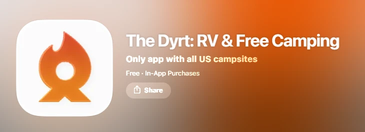
The Dyrt is a campground research and review app covering national park campgrounds, state parks, national forest sites, dispersed camping areas, glamping properties, and private RV parks across the United States in a single searchable database. For boondockers, the value is the dispersed camping coverage layered alongside the developed campground data, which allows trip planners to evaluate both options in the same interface.
The Dyrt Pro adds two features that matter specifically for boondockers. Offline maps that function without cell service cover the basic navigation need for remote areas. Sold-out campground alerts notify users when a previously unavailable national park or state park site opens due to cancellation, which is useful for boondockers who prefer managed sites when their preferred dispersed area is unexpectedly closed.
The Dyrt’s dispersed camping coverage is not as deep as FreeCampsites.net for pure public land boondocking. Its primary strength is the breadth of its database across all camping types and the quality of the review community for established sites.
Best for: Trip planning across all camping types, including dispersed and developed sites; catching cancellations at popular parks; and offline map access in the Pro tier.
Cost: Free basic version; Dyrt Pro available by paid subscription
Is Free Boondocking on Public Land Always Legal?
Free boondocking on public land is not automatically legal everywhere. Dispersed camping rules vary by land management agency, individual national forest, specific ranger district, and time of year. Several rules apply across most BLM and USFS land. Stays are typically limited to 14 consecutive days in one location before you must move at least 25 miles. Camping must be at least 200 feet from any water source on most BLM land. Campfire restrictions vary by season and are not always posted on digital maps in real time. Some areas within national forests are closed to motorized vehicle access entirely, and driving into them is illegal regardless of what a community-submitted GPS coordinate shows.
Go RVing’s boondocking expert guide recommends calling the local ranger district field office before your trip to confirm current conditions, fire restrictions, and access road status for your specific rig size. That direct confirmation, combined with a Gaia GPS MVUM layer check and a Campendium review read, is the standard due diligence for any boondocking destination you have not personally visited before.
FAQ
What is the best completely free app for finding boondocking spots?
FreeCampsites.net and iOverlander are both completely free and the two most focused databases for public land dispersed camping. FreeCampsites.net covers BLM and USFS land with detailed community reviews on road conditions and rig size compatibility. iOverlander provides GPS-accurate community spots in remote areas, including backcountry and international locations where other databases have no data. Campendium is also free and adds carrier-specific cell signal ratings that the other two do not surface. Using all three together before any remote boondocking trip covers the full range of public land data currently available without a paid subscription.
Do boondocking apps work without cell service?
Most boondocking apps require an active internet connection to load maps and campsite data. Gaia GPS Premium and The Dyrt Pro both offer dedicated offline map downloads that function without cell coverage once the maps are downloaded in advance. Gaia GPS additionally provides access to USFS Motor Vehicle Use Maps offline, which is the most important single data layer for legal navigation on forest roads. Download offline maps for your intended region before leaving areas with cell coverage. iOverlander caches GPS coordinates for previously viewed spots and can be referenced without live data in areas with no signal, though its offline capability is more limited than dedicated offline map tools.
What do I do when BLM boondocking spots near my route are full?
Seasonal pressure on popular BLM land means the most accessible spots in regions like the Sonoran Desert, Quartzsite, and dispersed areas near national parks fill for extended periods during peak travel months. When public spots are at capacity, private land through HookHub provides a confirmed alternative, with some hosts offering off-grid arrangements that approximate the boondocking experience on rural property. Expanding your search radius using FreeCampsites.net and Campendium to lesser-known dispersed areas farther from major highways is the other approach, combined with a Gaia GPS road access check before committing to a remote site.
The best boondocking app is the one that matches how and where you camp. For remote backcountry routes, iOverlander and Gaia GPS handle GPS accuracy and offline navigation. For pre-trip research on established public land spots, FreeCampsites.net and Campendium deliver the most useful community data. For nights when public land is unavailable, search confirmed private land hosts near your route.
Find private RV parking near you and see what hosts are available across the country.